The Art of Getting Lost: When Paper Maps Made Every Journey an Adventure
Pull into any gas station today and watch someone fumble with their phone, desperately trying to get their GPS to recalculate. Now imagine doing that same road trip in 1985, when your most sophisticated navigation tool was a folded paper map that refused to refold properly and a gas station attendant who might know the area—or might not.
When Navigation Required Actual Skills
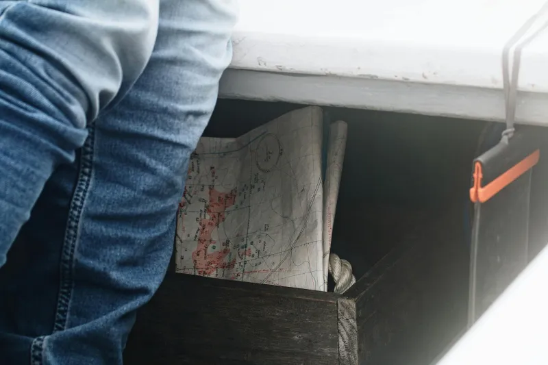
For decades, American road trips began at the kitchen table with a ritual as sacred as packing snacks: plotting your route with a highlighter on a Rand McNally atlas. Parents would trace interstate highways with their finger while kids pressed their faces against the pages, marveling at the web of roads that connected every corner of the country.
The smart travelers ordered AAA TripTiks—custom spiral-bound booklets that AAA staff created by hand for each member's specific journey. These weren't generic directions; they were personalized navigation guides complete with highlighted routes, recommended stops, and warnings about construction zones. A TripTik for a cross-country drive could span dozens of pages, each one covering roughly 50 miles of your journey.
But here's what made those days fundamentally different: getting lost wasn't a system failure—it was part of the experience.
The Democracy of Direction-Giving
Without Siri to consult, Americans became a nation of amateur cartographers and impromptu tour guides. Gas station attendants doubled as local navigation experts, sketching routes on napkins and offering insider knowledge about shortcuts that wouldn't appear on any official map. "Take Highway 9 until you see the big red barn, then hang a left," they'd say, creating a treasure hunt out of basic transportation.
Strangers at rest stops would huddle over maps spread across picnic tables, comparing routes and sharing intelligence about road conditions ahead. Everyone had a story about the scenic detour they discovered by accident or the small town they never would have found if they hadn't taken that wrong turn in Missouri.
When Wrong Turns Added Hours, Not Minutes
Miss your exit today, and your GPS immediately recalculates, adding maybe five minutes to your trip. Miss your exit in 1982, and you might not realize your mistake until you'd driven 50 miles in the wrong direction. There was no gentle voice saying "recalculating"—just the sinking realization that the landscape outside your window didn't match what you'd expected to see.
Those mistakes had real consequences. A wrong turn could add two hours to your journey, forcing you to stop at a motel you hadn't planned on or arrive at your destination well past dinner time. But they also created the unexpected moments that became family legends: the roadside diner with the best pie in three states, discovered only because Dad took the wrong exit outside Tulsa.
The Skill Set We've Lost
Navigating by paper map required a collection of abilities that have largely vanished from American life. You had to understand scale and distance, interpret topographical symbols, and maintain a running mental picture of where you were in relation to where you wanted to be. Most importantly, you had to pay attention.
Map readers developed an intuitive sense of direction and distance. They could estimate travel times by studying the thickness of road lines and calculating the curves of mountain passes. They knew that taking the interstate might be faster, but those thin blue lines marking scenic routes often led to the most memorable parts of the trip.
The Social Contract of Getting Lost
Pre-GPS America operated on an unspoken agreement: if someone looked lost, you helped them. Gas stations kept local maps behind the counter and gave them away free. Convenience store clerks expected to provide directions as part of their job description. Even ordinary citizens would pull over to help a stranded motorist studying a map on their hood.
This created a social fabric that connected travelers to the places they visited. Instead of following a disembodied voice through unfamiliar territory, road-trippers engaged with locals, learned about regional quirks, and discovered hidden gems that no algorithm would ever recommend.
What We Gained—And What We Lost
Today's navigation technology has eliminated the anxiety of getting lost, made travel more efficient, and opened up road trips to people who might have been intimidated by map reading. You can drive from Seattle to Miami following nothing but a blue line on your phone screen, never once wondering if you're going the right way.
But something intangible disappeared when we outsourced navigation to satellites. The journey became less important than the destination. Serendipity gave way to optimization. The adventure of figuring out where you were—and where you were going—became an obsolete skill.
The Unexpected Gift of Uncertainty
Perhaps the most significant change isn't technological—it's psychological. When getting lost was a real possibility, travelers approached their journeys differently. They built in extra time, remained alert to their surroundings, and stayed open to unexpected discoveries. The uncertainty that made map-based navigation stressful also made it engaging.
Today, as GPS guides us efficiently from point A to point B, we might arrive faster and with less stress. But we also arrive with fewer stories to tell and fewer accidental memories to treasure. Sometimes the best destinations are the ones you never meant to find.